153 countries
(and areas)
 - Andorra
- Antigua and Barbuda
- Argentina
- Armenia
- Aruba
- Australia
- Austria
- Azerbaijan
- Bahrain
- Barbados
- Belgium
- Belize
- Benin
- Bhutan
- Bolivia
- Bonaire
- Bosnia and Herzegovina
- Botswana
- Brazil
- British Virgin Islands
- Brunei
- Bulgaria
- Cambodia
- Canada
- Cape Verde
- Chile
- China
- Costa Rica
- Croatia
- Cuba
- Curacao
- Cyprus
- Czech Republic
- Denmark
- Dominica
- Dominican Republic
- Egypt
- El Salvador
- England
- Estonia
- Eswatini (Swaziland)
- Ethiopia
- Fiji
- Finland
- France
- French Guiana
- Georgia
- Germany
- Gibraltar
- Greece
- Grenada
- Guadeloupe
- Guatemala
- Honduras
- Hong Kong
- Hungary
- Iceland
- India
- Indonesia
- Iran
- Ireland
- Israel
- Italy
- Jamaica
- Japan
- Jordan
- Kazakhstan
- Kenya
- Kosovo
- Kuwait
- Kyrgyzstan
- Laos
- Latvia
- Lebanon
- Lesotho
- Liechtenstein
- Lithuania
- Luxembourg
- Macau
- Madagascar
- Malawi
- Malaysia
- Maldives
- Malta
- Martinique
- Mexico
- Moldova
- Monaco
- Mongolia
- Montenegro
- Morocco
- Mozambique
- Namibia
- Nepal
- Netherlands
- New Zealand
- Nicaragua
- North Macedonia
- Northern Ireland
- Norway
- Oman
- Pakistan
- Palestine
- Peru
- Philippines
- Poland
- Portugal
- Qatar
- Republic of Korea
- Romania
- Russia
- Saint Kitts and Nevis
- Saint Lucia
- Saint Martin
- Saint Vincent and the Grenadines
- San Marino
- Saudi Arabia
- Scotland
- Senegal
- Serbia
- Singapore
- Sint Maarten
- Slovakia
- Slovenia
- South Africa
- Spain
- Sri Lanka
- Suriname
- Sweden
- Switzerland
- Tajikistan
- Tanzania
- Thailand
- The Gambia
- Tibet
- Togo
- Transnistria
- Trinidad and Tobago
- Tunisia
- Turkey
- Turkmenistan
- Uganda
- United Arab Emirates
- United States
- Uruguay
- Uzbekistan
- Vatican City
- Vietnam
- Wales
- Zambia
- Zanzibar
- Andorra
- Antigua and Barbuda
- Argentina
- Armenia
- Aruba
- Australia
- Austria
- Azerbaijan
- Bahrain
- Barbados
- Belgium
- Belize
- Benin
- Bhutan
- Bolivia
- Bonaire
- Bosnia and Herzegovina
- Botswana
- Brazil
- British Virgin Islands
- Brunei
- Bulgaria
- Cambodia
- Canada
- Cape Verde
- Chile
- China
- Costa Rica
- Croatia
- Cuba
- Curacao
- Cyprus
- Czech Republic
- Denmark
- Dominica
- Dominican Republic
- Egypt
- El Salvador
- England
- Estonia
- Eswatini (Swaziland)
- Ethiopia
- Fiji
- Finland
- France
- French Guiana
- Georgia
- Germany
- Gibraltar
- Greece
- Grenada
- Guadeloupe
- Guatemala
- Honduras
- Hong Kong
- Hungary
- Iceland
- India
- Indonesia
- Iran
- Ireland
- Israel
- Italy
- Jamaica
- Japan
- Jordan
- Kazakhstan
- Kenya
- Kosovo
- Kuwait
- Kyrgyzstan
- Laos
- Latvia
- Lebanon
- Lesotho
- Liechtenstein
- Lithuania
- Luxembourg
- Macau
- Madagascar
- Malawi
- Malaysia
- Maldives
- Malta
- Martinique
- Mexico
- Moldova
- Monaco
- Mongolia
- Montenegro
- Morocco
- Mozambique
- Namibia
- Nepal
- Netherlands
- New Zealand
- Nicaragua
- North Macedonia
- Northern Ireland
- Norway
- Oman
- Pakistan
- Palestine
- Peru
- Philippines
- Poland
- Portugal
- Qatar
- Republic of Korea
- Romania
- Russia
- Saint Kitts and Nevis
- Saint Lucia
- Saint Martin
- Saint Vincent and the Grenadines
- San Marino
- Saudi Arabia
- Scotland
- Senegal
- Serbia
- Singapore
- Sint Maarten
- Slovakia
- Slovenia
- South Africa
- Spain
- Sri Lanka
- Suriname
- Sweden
- Switzerland
- Tajikistan
- Tanzania
- Thailand
- The Gambia
- Tibet
- Togo
- Transnistria
- Trinidad and Tobago
- Tunisia
- Turkey
- Turkmenistan
- Uganda
- United Arab Emirates
- United States
- Uruguay
- Uzbekistan
- Vatican City
- Vietnam
- Wales
- Zambia
- Zanzibar


Copyright 2004 - 2026
Veeronline.nl Travel Adventures
Home > Norway > To the Far North of Europe > Travelogue day 24
Travelogue To the Far North of Europe
July 126 2017 (26 days)
Norway > The climb of the Preikestolen
Dag 24 - Monday, July 24, 2017When we open the curtains, it is cloudy. Cautiously, a ray of sun breaks through the clouds. The most important thing: it is dry. After breakfast, we drive to Preikestolen.

Preikestolen is a 605-meter-high steep cliff that juts out above the Lysefjord. On top is a flat plateau. It is clear that all the other tourists in this area are also only traveling via Jørpeland to climb this remarkable rock. All the cars on the road turn off at Preikestolen. On the parking lot, many cars are already there, and it is only eight o’clock. Quickly, we set off as well. The trail to the top is four kilometers long. Every 150 meters, signs indicate how far you have come. At first, it feels as if progress is slow. Via a staircase built from rocks, we gain height quickly. After two kilometers, the trail becomes flatter. We are on the high plateau. From this height, there is already a nice view of the surroundings. After an hour and a half of climbing, we reach Preikestolen. From the plateau, we can see the Lysefjord six hundred meters below. What a stunning sight. It feels quite thrilling to look over the edge. The rock is completely vertical. There are no railings. On the edge of the rock, we take photos. On the way back, there are two routes: the regular route or the Hill trail. We choose the latter. Over the rocks, we climb to the rock point just above Preikestolen. From there, we descend again. Still, we must have gone wrong somewhere because we miss the signs indicating the path. In the distance, we see the original route again. Using the rocks, we make our way down. Back on the original trail, the descent is easier. It has become much busier on the route. Hundreds of tourists have also started their climb. For some, it is easier than for others. Around half past eleven, we are back on the parking lot. We unfold our chairs and heat up a can of soup. Just as we are packing up our things again, it starts to drizzle. As soon as we drive off the parking lot, a downpour begins. The weather forecast that it would start raining from noon is correct. We realize we were lucky with our hike, but immediately think of the many people still on the mountain. We drive south. The goal for today is Kristiansand, the southernmost tip of Norway. At Oanes, we cross the Høgsfjord by ferry. As we arrive, loading is just beginning. Again, we are lucky with the boat. After the ferry, we continue on the main E39.

The landscape here is less rugged, so the road has fewer sharp curves. The driving is smooth. Around five o’clock, we enter the center of Kristiansand. We have an apartment in the city center. It is unclear whether we may park in front of the apartment. The sign indicates a maximum of three hours and that payment is required between eight and five. We consult several passersby but cannot reach a conclusion. The question is whether the three-hour limit also applies after the paid parking period ends. Opinions differ. We decide to park the car for three hours first. We’ll see afterward. We also need a ticket for this. When we insert one Norwegian krone into the machine, we get a ticket valid until eight o’clock the next morning. The problem is solved. With this ticket, we can stay until tomorrow morning. We are leaving early anyway to catch the 6:45 ferry. In the evening, we walk along the beach, the Christianholm Fortress, and the marina. We eat at a seafood restaurant in the harbor. We toast with a beer to the last evening in Norway. We go to bed on time. Tomorrow, we have to get up early.
 Norway


 Finland
Travelogue To the Far North of Europe
Dag 2 | Poland > The old center of Gdansk
Dag 3 | Poland > The castle of Marienburg
Dag 4 | Lithuania > Counting lakes on the way to Vilnius
Dag 5 | Latvia > The Hill of Crosses in Šiauliai
Dag 6 | Estonia > Medieval Tallinn
Dag 7 | Finland > By boat to Helsinki
Dag 8 | Finland > The Karelia lake district
Dag 9 | Finland > A moose on the road
Dag 10 | Finland > Visiting Santa Claus
Dag 11 | Finland > Hiking in Urho Kekkonen
Dag 12 | Norway > Around midnight at the North Cape
Dag 13 | Norway > The Hammerfest Polar Bear Society
Dag 14 | Norway > The car won't start anymore
Dag 15 | Norway > A new starter motor in Hammerfest
Dag 16 | Norway > Driving above the Arctic Circle
Dag 17 | Norway > The beautiful Lofoten Peninsula
Dag 18 | Norway > Back to the mainland
Dag 19 | Norway > Whirlpools at the Saltstraumen
Dag 20 | Norway > The old merchant houses of Trondheim
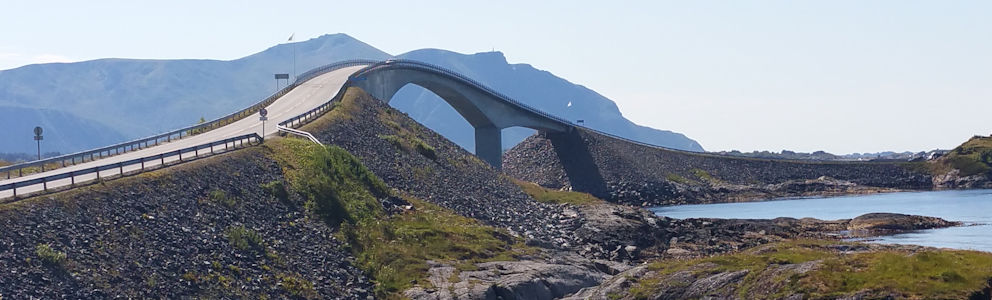
Dag 21 | Norway > The Atlantic Ocean Road
Dag 22 | Norway > Along mountain roads and fjords
Dag 23 | Norway > Along the Hardangerfjord
Dag 24 | Norway > The climb of the Preikestolen
Dag 25 | Denmark > The Danish Sønderborg Castle
Dag 26 | Netherlands > On the way home