
154 countries
(and areas)
 - Belize
- Benin
- Bhutan
- Bolivia
- Bonaire
- Bosnia and Herzegovina
- Botswana
- Brazil
- British Virgin Islands
- Brunei
- Bulgaria
- Cambodia
- Canada
- Cape Verde
- Chile
- China
- Costa Rica
- Croatia
- Cuba
- Curacao
- Cyprus
- Czech Republic
- Denmark
- Dominica
- Dominican Republic
- Egypt
- El Salvador
- England
- Estonia
- Eswatini (Swaziland)
- Ethiopia
- Fiji
- Finland
- France
- French Guiana
- Georgia
- Germany
- Gibraltar
- Greece
- Grenada
- Guadeloupe
- Guatemala
- Honduras
- Hong Kong
- Hungary
- Iceland
- India
- Indonesia
- Iran
- Ireland
- Israel
- Italy
- Jamaica
- Japan
- Jordan
- Kazakhstan
- Kenya
- Kosovo
- Kuwait
- Kyrgyzstan
- Laos
- Latvia
- Lebanon
- Lesotho
- Liechtenstein
- Lithuania
- Luxembourg
- Macau
- Madagascar
- Malawi
- Malaysia
- Maldives
- Malta
- Martinique
- Mexico
- Moldova
- Monaco
- Mongolia
- Montenegro
- Morocco
- Mozambique
- Namibia
- Nepal
- Netherlands
- New Zealand
- Nicaragua
- North Macedonia
- Northern Ireland
- Norway
- Oman
- Pakistan
- Palestine
- Peru
- Philippines
- Poland
- Portugal
- Qatar
- Republic of Korea
- Romania
- Russia
- Saint Kitts and Nevis
- Saint Lucia
- Saint Martin
- Saint Vincent and the Grenadines
- San Marino
- São Tomé and Principe
- Saudi Arabia
- Scotland
- Senegal
- Serbia
- Singapore
- Sint Maarten
- Slovakia
- Slovenia
- South Africa
- Spain
- Sri Lanka
- Suriname
- Sweden
- Switzerland
- Tajikistan
- Tanzania
- Thailand
- The Gambia
- Tibet
- Togo
- Transnistria
- Trinidad and Tobago
- Tunisia
- Turkey
- Turkmenistan
- Uganda
- United Arab Emirates
- United States
- Uruguay
- Uzbekistan
- Vatican City
- Vietnam
- Wales
- Zambia
- Zanzibar
- Belize
- Benin
- Bhutan
- Bolivia
- Bonaire
- Bosnia and Herzegovina
- Botswana
- Brazil
- British Virgin Islands
- Brunei
- Bulgaria
- Cambodia
- Canada
- Cape Verde
- Chile
- China
- Costa Rica
- Croatia
- Cuba
- Curacao
- Cyprus
- Czech Republic
- Denmark
- Dominica
- Dominican Republic
- Egypt
- El Salvador
- England
- Estonia
- Eswatini (Swaziland)
- Ethiopia
- Fiji
- Finland
- France
- French Guiana
- Georgia
- Germany
- Gibraltar
- Greece
- Grenada
- Guadeloupe
- Guatemala
- Honduras
- Hong Kong
- Hungary
- Iceland
- India
- Indonesia
- Iran
- Ireland
- Israel
- Italy
- Jamaica
- Japan
- Jordan
- Kazakhstan
- Kenya
- Kosovo
- Kuwait
- Kyrgyzstan
- Laos
- Latvia
- Lebanon
- Lesotho
- Liechtenstein
- Lithuania
- Luxembourg
- Macau
- Madagascar
- Malawi
- Malaysia
- Maldives
- Malta
- Martinique
- Mexico
- Moldova
- Monaco
- Mongolia
- Montenegro
- Morocco
- Mozambique
- Namibia
- Nepal
- Netherlands
- New Zealand
- Nicaragua
- North Macedonia
- Northern Ireland
- Norway
- Oman
- Pakistan
- Palestine
- Peru
- Philippines
- Poland
- Portugal
- Qatar
- Republic of Korea
- Romania
- Russia
- Saint Kitts and Nevis
- Saint Lucia
- Saint Martin
- Saint Vincent and the Grenadines
- San Marino
- São Tomé and Principe
- Saudi Arabia
- Scotland
- Senegal
- Serbia
- Singapore
- Sint Maarten
- Slovakia
- Slovenia
- South Africa
- Spain
- Sri Lanka
- Suriname
- Sweden
- Switzerland
- Tajikistan
- Tanzania
- Thailand
- The Gambia
- Tibet
- Togo
- Transnistria
- Trinidad and Tobago
- Tunisia
- Turkey
- Turkmenistan
- Uganda
- United Arab Emirates
- United States
- Uruguay
- Uzbekistan
- Vatican City
- Vietnam
- Wales
- Zambia
- Zanzibar


Copyright 2004 - 2026
Veeronline.nl Travel Adventures

Home > Iceland > Volcanoes Glaciers and Waterfalls > Travelogue day 7
Travelogue Volcanoes Glaciers and Waterfalls
August 113 2021 (13 days)
Iceland > The 128-meter-high Hengifoss
Dag 7 - Saturday 7 August 2021When we enter the breakfast room, the French tour group has just left. The staff quickly cleans a small table for us. The buffet is fine. Just after half past eight, we leave the hotel. We drive for half an hour along the wide water of the Lagarfljót river. The mountains on the opposite side reflect in the water. We cross the Lagarfljót via a bridge. Here begins a deep canyon leading to the Hengifoss waterfall. From the parking lot, we can already see the top part of the waterfall. Hengifoss, at 128.5 meters, is one of the highest waterfalls in Iceland. To reach the waterfall, we have to follow a two-kilometer path. The path rises steeply immediately from the parking lot. We walk up at a steady pace. Next to us, the fast-flowing water rushes down the canyon. Exactly halfway up the climb is a viewpoint overlooking the Litlanesfoss waterfall. This smaller waterfall lies among basalt formations. Here too, the basalt was formed during volcanic eruptions where the lava cooled quickly. The falling water between the basalt pillars is a beautiful sight. After a short break, we continue climbing. Hengifoss comes fully into view. We see the water falling from a great height. Because of the risk of falling rocks, we cannot get right under the waterfall. The view from the platform is impressive enough.

In the rock face, several layers can be seen. The red lines were formed by volcanic ash over which hot lava later flowed. The ash burned and formed a red stone layer. I count at least three layers of ash. On the other side of the Lagarfljót lies Iceland’s largest forest. Actually, Iceland has hardly any vegetation. Until today, we have barely seen any trees. Only in the region around Egilsstaðir do trees grow. We take a five-kilometer walk through the Hallormsstaður Forest. The forest lies against the mountainside. Our path climbs steeply. From a viewpoint, we look out over the trees and the water of the Lagarfljót. After the walk, we have a picnic lunch right by the river.

We are getting the hang of it. A picnic lunch really is the easiest way to eat. Restaurants are hardly to be found. After lunch, we head towards the east coast. Here lie the rugged fjords. Via an unpaved mountain road, we drive to Breiðdalsvík. When we cross the mountain pass, the weather quickly turns. This morning we walked in the sun. Now raindrops fall on the windshield. The low clouds hang mysteriously against the mountainsides. Carefully, we descend to Breiðdalsvík. At this small coastal village, we join the ring road again. The village itself and the weather do not invite us for a walk. It is still raining. In a hotel, we order something to drink. We drive along the coastal road to Djúpivogur. Here lies our accommodation for tonight, though it is about ten kilometers outside Djúpivogur. In the supermarket, we buy bread and toppings for tomorrow’s breakfast. We also pick up something for lunch. Prices here are much higher than in the bigger towns. Everything has to be brought here. For example, a kilo of minced meat costs the equivalent of thirty euros. We want to reserve a table at the Við Voginn restaurant for tonight. It turns out to be a kind of fast-food restaurant. Reservation is not necessary. “We close at eight,” a staff member warns us. We make sure to be back by seven. We drive the last bit to the Bragdavellir Cottages. A group of wooden houses at a farm. Via email, we received the name Kira. Our cottage. The door is open and the key lies on the table. A cozy chalet with two bedrooms. In the evening, we drive back to Djúpivogur to eat. When leaving the restaurant, we check the bill and find that the glass of wine was not charged. Alcoholic drinks are expensive in Iceland. Beer and wine often cost around ten euros a glass. We decide to leave it as it is and not go back.
 Iceland
  There is a beautiful view from the top of the mountains
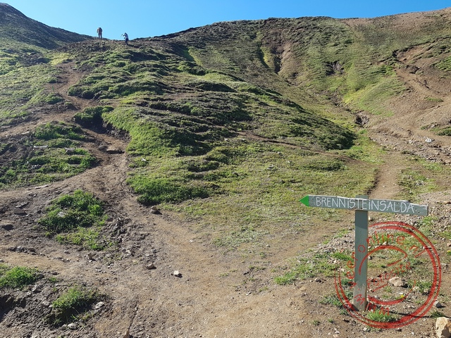 Here begins the climb to the 855meter high top of Brennisteinsalda
 The village of Borgarfjorur Eystri is the elf capital of Iceland
 The natural hot tub in Varmahli
Travelogue Volcanoes Glaciers and Waterfalls
Dag 2 | Iceland > The Snæfellsnes Peninsula
Dag 3 | Iceland > The Hraunfossar Lava Waterfall
Dag 4 | Iceland > Bubbling Mud
Dag 5 | Iceland > Whale Safari at Sea
Dag 6 | Iceland > The Impressive Dettifoss
Dag 7 | Iceland > The 128-meter-high Hengifoss
Dag 8 | Iceland > Sailing among the Icebergs
Dag 9 | Iceland > Hiking on the Glacier
Dag 10 | Iceland > Behind the Seljalandsfoss
Dag 11 | Iceland > Colorful Landmannalaugar
Dag 12 | Iceland > The Golden Circle
Dag 13 | Iceland > To Keflavík